
Filter by
SubjectRequired
LanguageRequired
The language used throughout the course, in both instruction and assessments.
Learning ProductRequired
LevelRequired
DurationRequired
SkillsRequired
SubtitlesRequired
EducatorRequired
Explore the Remote Sensing Course Catalog
 Status: Free Trial
University of Michigan
Skills you'll gain: Sustainable Development, Geographic Information Systems, Geospatial Mapping, Sustainability Reporting, Spatial Data Analysis, Sustainable Business, Spatial Analysis, Data Storytelling, Environmental Monitoring, Data Visualization, Stakeholder Engagement, Trend Analysis, Decision Making
 Status: Free Trial
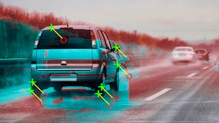
Skills you'll gain: Computer Vision, Image Analysis, Deep Learning, Matlab, Applied Machine Learning, Machine Learning, Motion Graphics, Supervised Learning, Predictive Modeling, Artificial Intelligence and Machine Learning (AI/ML), Visualization (Computer Graphics), Geospatial Information and Technology, Data Integration, Medical Imaging, Data Validation, Estimation, Machine Learning Methods, Performance Tuning, Algorithms
 Status: Free Trial
University of Colorado Boulder
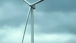
Skills you'll gain: Electrical Power, Electrical Systems, Electric Power Systems, Mechanical Engineering, Mechanical Design, Electronic Components, Energy and Utilities, Architectural Engineering, System Monitoring, Vibrations, Control Systems, Performance Tuning, Engineering Calculations
 Status: Preview
Duke University
Skills you'll gain: Environmental Monitoring, Environmental Regulations, Environmental Laws, Environmental Science, Geospatial Information and Technology, Ethical Standards And Conduct, Global Positioning Systems, Research, Data Management, Critical Thinking
 Status: Preview
École Polytechnique Fédérale de Lausanne
Skills you'll gain: Geographic Information Systems, Data Modeling, GIS Software, SQL, Database Design, Spatial Data Analysis, Database Management, Query Languages, Relational Databases, Data Capture, Data Storage
 Status: NewStatus: Free Trial
Case Western Reserve University
Skills you'll gain: Exploratory Data Analysis, Spatial Data Analysis, Spatial Analysis, Geospatial Information and Technology, Descriptive Statistics, Statistical Modeling, R Programming, Geographic Information Systems, Statistical Analysis, R (Software), Probability & Statistics, Ggplot2, Oil and Gas, Data Analysis, Simulations, Statistical Methods, Rmarkdown, Data Cleansing, Box Plots, Plot (Graphics)
 Status: Free Trial
MathWorks
Skills you'll gain: Computer Vision, Image Analysis, Matlab, Applied Machine Learning, Machine Learning, Supervised Learning, Predictive Modeling, Visualization (Computer Graphics), Data Validation, Performance Tuning
 Status: Free Trial
University of Colorado Boulder
Skills you'll gain: Climate Change Programs, Environment, Environmental Science, Mathematical Modeling, Environmental Monitoring, Hydrology, Simulations, Scientific Methods
 Status: Free Trial
University of Toronto
Skills you'll gain: ArcGIS, Spatial Data Analysis, Geographic Information Systems, Spatial Analysis, Geospatial Mapping, Data Mapping, Global Positioning Systems, Data Capture
 Status: Preview
École Polytechnique Fédérale de Lausanne
Skills you'll gain: Spatial Analysis, Spatial Data Analysis, GIS Software, Geographic Information Systems, Geospatial Mapping, Geostatistics, Interactive Data Visualization, Data Integration, Data Mapping, Augmented Reality, Sampling (Statistics)
 Status: Free Trial
University of Toronto
Skills you'll gain: Spatial Analysis, Geographic Information Systems, Geospatial Mapping, ArcGIS, Data Visualization, Data Compilation, Data Mapping, Data Storytelling, Metadata Management, Data Integration, Data Management
 Status: NewStatus: Free Trial
Skills you'll gain: Photography, Photo Editing, Image Quality, Design Elements And Principles, Adobe Creative Cloud
In summary, here are 10 of our most popular remote sensing courses
- GIS: Geographic Information Systems for Sustainability: University of Michigan
- Computer Vision for Engineering and Science: MathWorks
- Wind Turbine Sensors: University of Colorado Boulder
- Drones for Environmental Science: Duke University
- Systèmes d’Information Géographique - Partie 1: École Polytechnique Fédérale de Lausanne
- Practical Geospatial Geostatistical Modeling: Case Western Reserve University
- Machine Learning for Computer Vision: MathWorks
- Polar Peril: University of Colorado Boulder
- Introduction to GIS Mapping: University of Toronto
- Geographical Information Systems - Part 2: École Polytechnique Fédérale de Lausanne


